

Berlin, CT
Ragged Mountain
Real cliff-top views over Wassel Reservoir, with views along the way, plus the rock scrambles I'd been after. Do it as an out-and-back to the clifftop for the views, because the loop's back half is all woods with the trail markings missing.
Drive time
About 35 min
Difficulty
Challenging. Rocky traprock with real rock scrambles and cliff edges climbing to the clifftop at 2.3 miles. The full loop adds a rough, poorly-marked woods section on the back half.
Distance
For the views, do the clifftop as an out-and-back, about 4.6 miles round trip (2.3 each way). The full blue/red loop is about 5.5 miles, but the back half is all woods with missing blazes.
Admission
Free — Ragged Mountain Memorial Preserve
Parking
Very limited. There's no real lot, so you park on the street at the end of West Lane in Berlin, at the bend where it becomes Wigwam Road, across from #437 West Lane. Navigate to 437 West Lane, Berlin, not the summit, and go early.
Bathrooms
None at the trailhead — go before you come
Picnic
No tables; the clifftop over the reservoir is the lunch spot
Dogs
Yes, on leash, but it's rugged, so a sure-footed dog only.
The trip
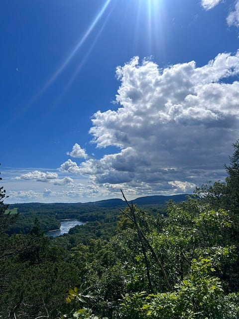
This was the one I'd been saving for a real workout with real views, and it delivered on both, with a couple of honest catches. Ragged Mountain is traprock like my favorites, part of the blue-blazed Metacomet ridge in Berlin, and it finally gave me the rock scrambles I'd been after, plus cliff-top views out over Wassel Reservoir. There are views along the way up, too, not as many as Higby, but definitely there, which is exactly what I'd been chasing after a couple of viewless woods hikes.
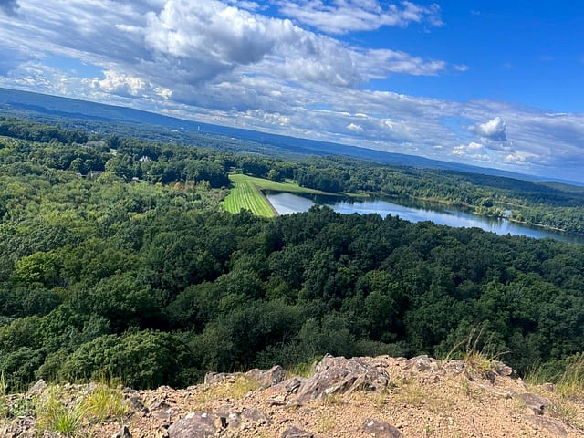
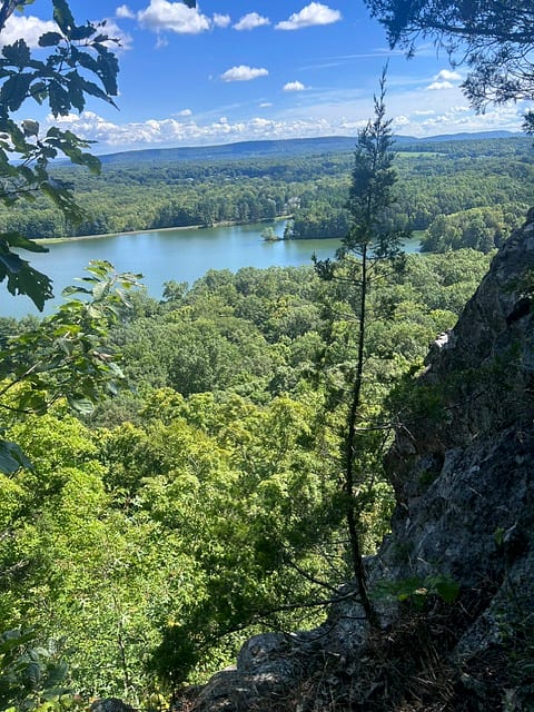
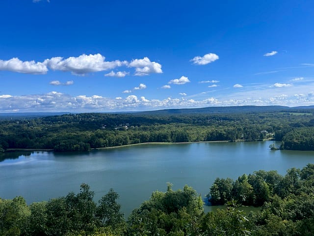
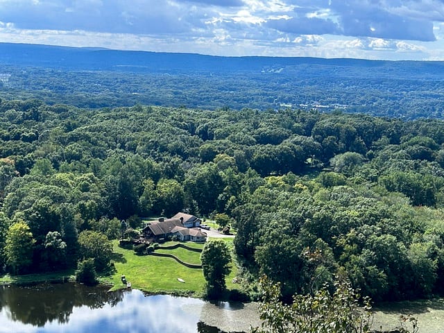
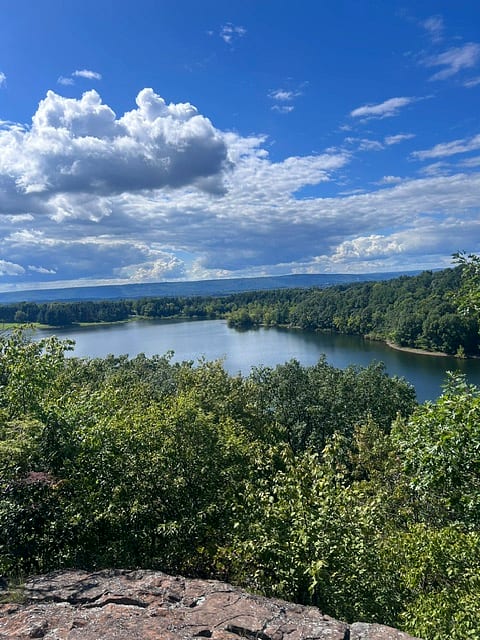
The heart of the hike is the first 2.3 miles. You climb, scramble over rock, catch views through the trees along the way, and top out at a clifftop with the best view of the day: the reservoir spread out below with the ridges and valley beyond. That stretch is genuinely great, cliff-over-water in the same family as Chauncey but bigger and more rugged. If you want the views, my honest advice is to make the clifftop your turnaround and go back the way you came, an out-and-back of about 4.6 miles.
Two point three miles up to a clifftop over Wassel Reservoir, with views along the way. That stretch is the hike. Turn around there, because the rest of the loop is all woods with the blazes knocked down.
Because here's the catch on the loop. After the clifftop, the rest of the way is all woods, no more views. Worse, the trail was a mess of downed trees, and a lot of them had the blazes on them, so the markings were knocked to the ground and missing in stretches. I passed a few lost hikers, and at points I was basically making my own trail. This is a download-the-map-before-you-go hike for sure, and even then the back half is a slog. I also got caught in a rain shower over the last three miles, which didn't help.
So the verdict: the views-and-scrambles half up to the clifftop is exactly my kind of hike, and I'm glad I finally did it. But the full loop's back half is a viewless, poorly-marked woods walk I wouldn't repeat. Next time I'd do the clifftop out-and-back, get all the good stuff, and skip the rest. Parking is tight, on the street at the end of West Lane, so get there early.
From the trail
Photos
The plan
Stop by stop
- 1Trailhead
West Lane trailhead
Early morning · Start herePark on the street at the end of West Lane, at the bend where it becomes Wigwam Road, across from #437 West Lane (navigate to the address, not the summit). Very limited, so go early. Download the blue/red loop before you start, because downed trees have knocked a lot of the blazes to the ground.
- 2Hike
The climb and scrambles to the clifftop
Morning · About 2.3 mi upThe first 2.3 miles are the hike: a real climb over rocky, scrambly traprock with views opening through the trees along the way. This is the workout and the payoff rolled together. Watch the blazes closely, they're knocked down in spots.
- 3Lookout
The clifftop over Wassel Reservoir
At the top · As long as the view holds youThe best view of the day at 2.3 miles: a clifftop looking down over Wassel Reservoir with the valley and ridges beyond. This is the spot. For a views day, make this your turnaround and head back the way you came, about 4.6 miles round trip. Steep, unrailed cliff edges, so keep kids well back.
- 4Hike
The loop's back half (optional, and rough)
If you continue · The back ~3 miOnly if you want the miles: past the clifftop the full loop is all woods with no more views, and the trail was a mess of downed trees with the blazes knocked off, missing in stretches. I saw lost hikers and had to route-find. Skippable, and I'd skip it next time.
Checking this weekend's weather…
Kid rating
★★★☆☆
Snack rating
★★★☆☆
Dad rating
★★★★☆
Would we go again?
Absolutely
“Yes, but only as the clifftop out-and-back. The first 2.3 miles up to the cliff over Wassel Reservoir are exactly my kind of hike: real scrambles, views along the way, and a big cliff-over-water payoff. The full loop's back half is a viewless, poorly-marked woods slog with the blazes knocked down, and I got rained on out there. Next time I'll do the clifftop and turn around.”
Dad tips
- ▸Do the clifftop as an out-and-back for the views. The first 2.3 miles up to the clifftop over Wassel Reservoir are the whole reason to come, about 4.6 miles round trip. Turn around at the clifftop.
- ▸Skip the full loop unless you just want miles. Past the clifftop it's all woods, no views, and the trail is rough. I'd do the out-and-back every time.
- ▸Download the map, no exceptions. Downed trees have knocked a lot of the blazes to the ground, so the markings are missing in stretches. I passed lost hikers and had to make my own trail at points.
- ▸There are views along the way up, not as many as Higby, but real ones, plus a genuine cliff-over-reservoir payoff at the top. It's got the scramble challenge too.
- ▸Parking is very limited. There's no lot, so park on the street at the end of West Lane across from #437, and go early.
- ▸Check the forecast. I got rained on for the last three miles, and the exposed clifftop is the last place you want to be in a storm.
- ▸Real grippy shoes for the scrambles, water, and keep kids well back from the unrailed cliff edges. Sure-footed dogs only, on leash.
What to bring
- ✓Sturdy hiking shoes with real grip (rock scrambles)
- ✓Plenty of water (exposed clifftop, real climbing)
- ✓Your phone with the route downloaded (blazes are down in spots, this is essential here)
- ✓A rain layer, and check the forecast before you go
- ✓A hat and sunscreen for the open clifftop
- ✓A snack or lunch to eat up at the reservoir view
Best time to visit
Fall for the foliage off the cliffs. Check the forecast, the exposed clifftop is no place to be in a storm.
While you're out there
Nearby stops
Keep exploring
Related adventures
 Bigger Hikes
Farmington, CT
Rattlesnake Mountain
The quiet pick. A short, steep traprock climb on the blue-blazed Metacomet Trail to clifftop views west over the Pequabuck valley toward the Berkshires. Farmington. Next on the list.
 Bigger Hikes
Bethany, CT
Beacon Cap
A quiet, all-woods loop to a striking glacial boulder in the Naugatuck State Forest. Good exercise and total solitude, but no views the whole way except the one you climb the rock for. Honestly, not my favorite.
 Bigger Hikes
Hamden, CT
West Rock Ridge
My favorite hike, just ahead of Mount Higby, and it's the closest real ridge to home. A busy family pond at the bottom with fishing and a bathroom, then you climb and the ridge is all yours, quiet enough to hear the chickadees. About 20 minutes away.